
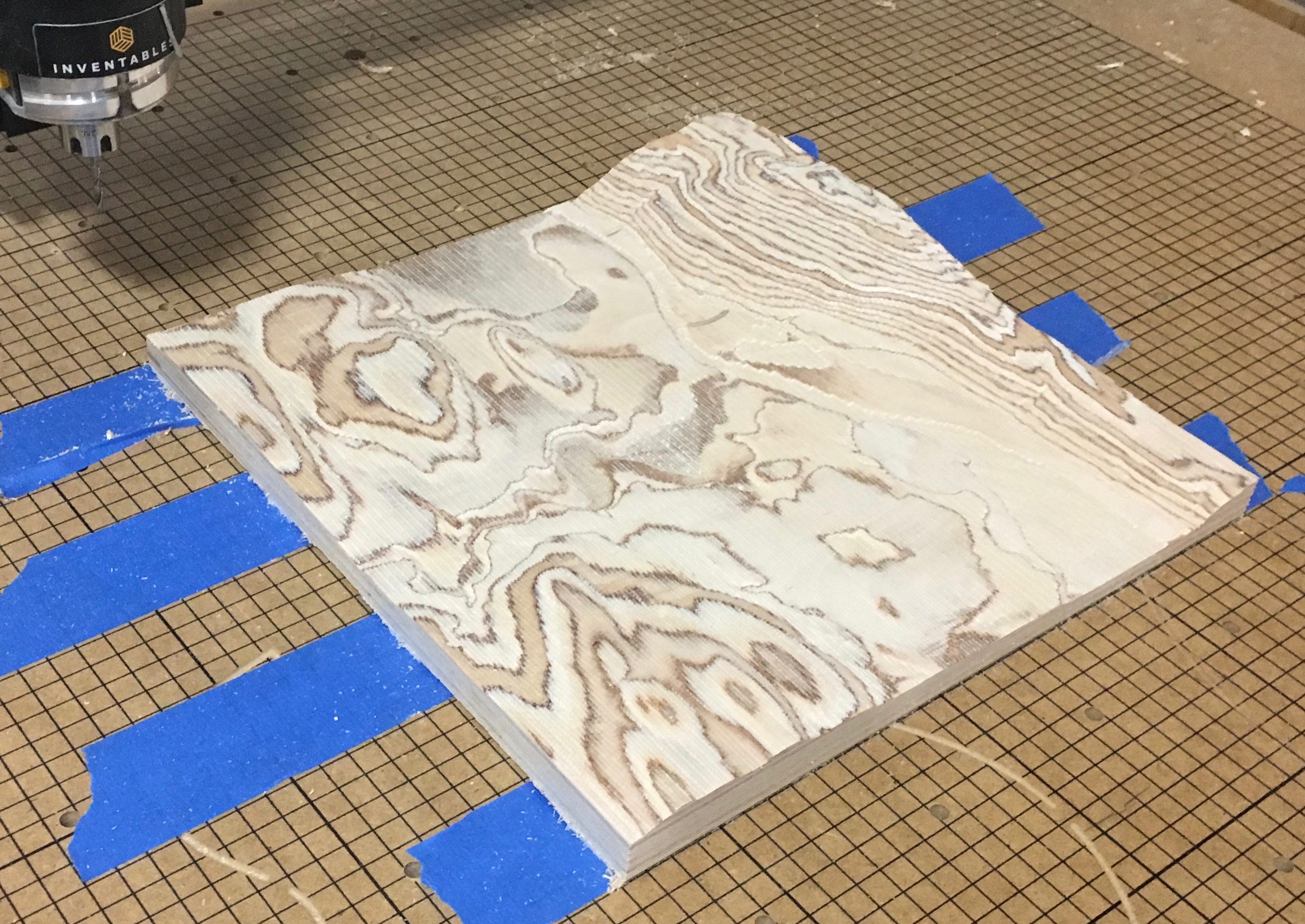
A 3D map of the Brattleboro area carved into birch plywood.
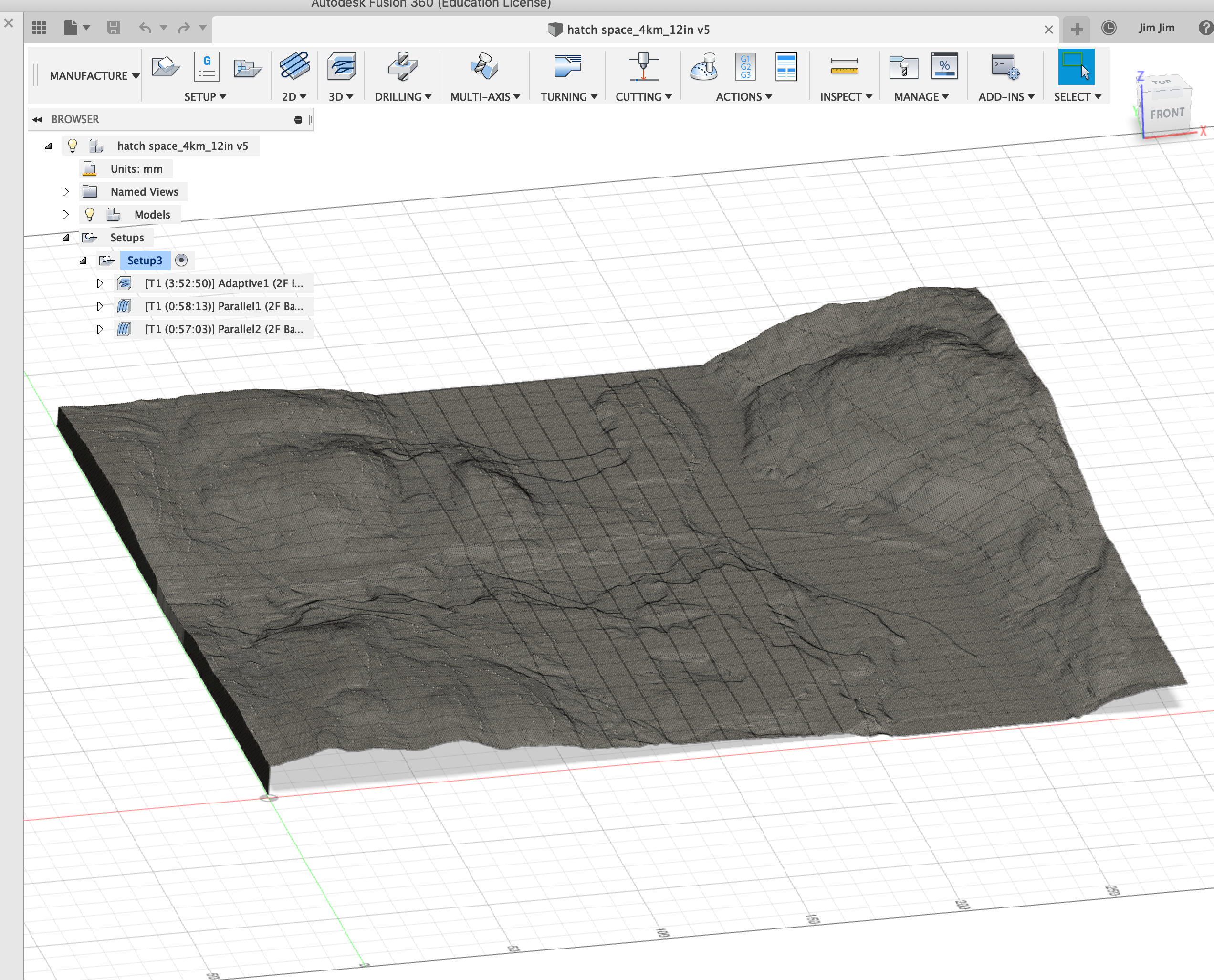
The elevation data is from the USGS National Elevation Dataset, which is massaged into a 3D STL file with a numerical python jupyter notebook.
The STL file is converted to a .nc file containing G-code which tells the router how to carve the wood. This conversion is complex - the software needs to know the shape (or shapes) of the drill bits, and there are a number of choices in what paths to use through the wood.
I used for this, customized with some data from inventables to set the drill shapes and allowed g-codes for the X-Carve's controller.
(back to xcarve projects)